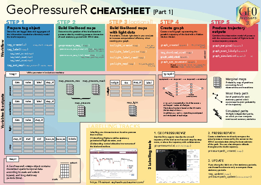
GeoPressureR is a R package which help researchers construct the trajectory of a bird equipped with an atmospheric pressure sensor. The package is a direct implementation of methods presented in Nussbaumer et al. (2023a) and Nussbaumer et al. (2023b).
Installation
The best way to install the GeoPressureR package is through Github
# install.packages("pak")
pak::pkg_install("Rafnuss/GeoPressureR")
Learn how to use GeoPressureR
The GeoPressureManual is a great place to start learning about how to use GeoPressureR.
Using the examples, this user guide takes you through each step of the analysis in detail.

Start your own analysis
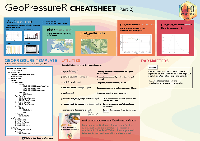
Once you are familiar with the workflow of the method and want to start your own study, we suggest you use GeoPressureTemplate, a github template repository which provides a standard code structure for your analysis.
Using this standardized code structure you will help you on many aspect: code sharing and troubleshooting, data archiving, work reproducibility.